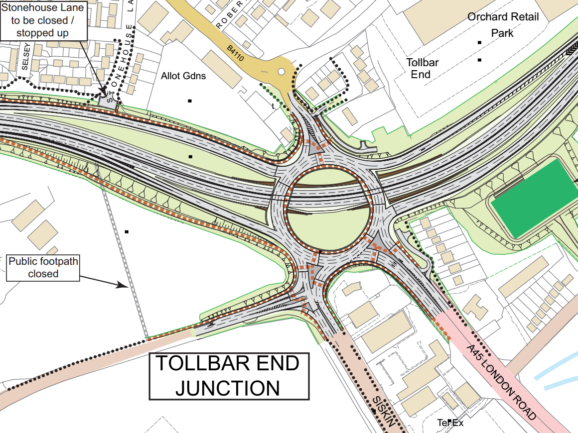
Shared pedestrian/cyclist paths are provided, shown as brown dashed lines.
It's certainly not the best possible solution. Cyclists in a hurry might prefer the carriageway as it has fewer traffic lights than the paths. Subways would be a better solution, but would cost a lot. Such sums might be better spent on other ways of getting cyclists past the A45/A46.
Two potential cycle routes crossing the A45/A46:
- Between Willenhall, the site of the old Peugoet factory and Ryton village. This would encourage people working at the industrial site and living in Coventry or Ryton to cycle to work. There's already a subway under the A46 between Willenhall Wood and Orchard Retail Park.
- Between Whitley and Baginton. A new bridge over the A45/A46 is proposed as part of a development south of the A45.
With the first idea in mind I sent an email to Rugby Borough Council on 28 November suggesting that the former Peugoet factory development should include a cycle route segregated from motor traffic, running between Tollbar End and Ryton. The reply was swift and full. The opportunity for making the route a condition for granting planning approval should have been made in 2008 or 2011. But neither the Highways Agency nor Warwickshire County Council Highways Department raised the matter.
Neither Warwickshire County Council or the Highways Agency seem bothered that people will only access the site by car. They seem not to understand that if a better cycle route were provided it would take local car traffic off this congested part of the 'Strategic Road Network', as well as giving local people more opportunity to increase their cardiovascular fitness levels.
* *
Also in November, I received details about the signing for Non Motorised Users of TollBar End. The direction signs seemed reasonable, what annoyed me were the proposed "Cyclists Dismount" and "End of Cycle Route" signs.
Back in March 2012, the Department of Transport conceded that "Cyclists Rejoin Carriageway" normally made more sense than "Cyclists Dismount"(see link - look for 'diagram 966')
"[This] sign should be provided only where cyclists are required to use a pedestrian crossing facility that they cannot legally cycle on, at the entrance to a pedestrian area, at a location with a low headroom or width restriction [...] or at places where visibility is restricted to such an extent that cycling would be unsafe" (link)
I wonder how long it will take for the Department of Transport's insight to reach the Highway Agency's contractors (Hyder Consulting)?
The "End of Cycle Route" sign is a useless waste of space. It's placed at the scheme's boundaries; where the authorities couldn't think of any other sign.
Where are the "End of Motor Route" signs?


